What Driveway Drone Photography Actually Is—and Why It Matters
Driveway drone photography is the use of FAA-registered unmanned aircraft to capture ultra-high-resolution aerial images and short 4K videos of your driveway, front yard, and surrounding hardscape. One five-minute flight can produce 30–50 stills, a 360° panorama, and a top-down orthomosaic accurate to ½ inch—enough detail to see every crack, oil stain, and drainage swale.
For homeowners, the payoff is three-fold:
- Planning: See how a wider turn-around or extra parking pad will fit before you pay a contractor.
- Maintenance: Track cracks, potholes, and edge spalling season-to-season.
- Marketing: A dramatic “after” aerial shot can add 5–7 % to resale value, according to NAR’s 2023 Remodeling Impact Report.
Top Benefits of Aerial Driveway Imaging
1. Spot Drainage Issues You Miss at Ground Level
A 45° downward angle reveals low spots where water pools. Mark them on the orthophoto and hand the file to your seal-coating crew so they can micro-grade before applying sealer.
2. Measure True Square Footage Without a Tape
Drone software geotags every pixel. Trace the driveway outline on screen and you’ll get area, slope, and even elevation change—handy for comparing quotes that charge by the square foot.
3. Document “Before” Conditions for Warranty Claims
If a new asphalt layer fails within the warranty period, time-stamped drone images prove whether the base was pre-cracked or if the damage happened post-installation.
4. Boost Curb-Appeal Listings
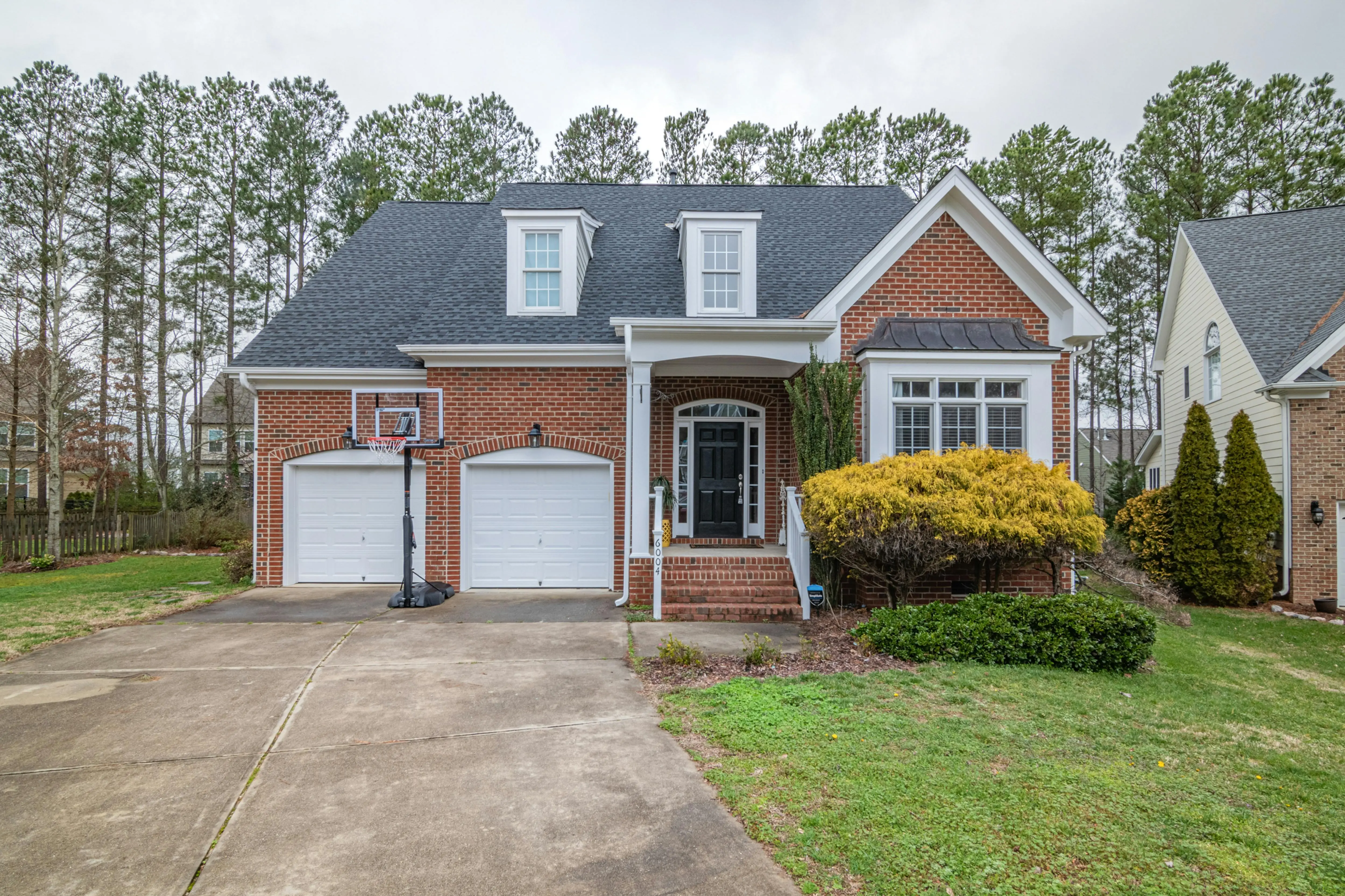
MLS photos taken from the sidewalk hide half the property. An aerial hero shot shows the full sweep of a paver driveway, integrated landscaping, and circular motor court—features today’s buyers scroll for.
When to Schedule a Drone Shoot
- Pre-Design: Bring the footage to your first design-build meeting; it shortens the on-site survey by 30 minutes.
- Post-Installation: Capture the pristine “day-one” condition for future comparison.
- Annual Maintenance: Book the same month every year to build a visual history.
- Pre-Sale: Shoot two weeks before listing so grass is green but trees haven’t fully leafed out (better pavement visibility).
Legal & Safety Checklist for Homeowners
FAA Part 107 & Recreational Rules
Any provider you hire must hold a Remote Pilot Certificate (Part 107). Ask for their FAA tracking number and verify it on the FAA’s public database. Recreational flyers can legally shoot your property, but they can’t charge money—so you won’t have recourse if the images are poor.
Airspace Authorization
Most suburban neighborhoods sit in Class G (uncontrolled) airspace, but if you’re within five miles of a hospital helipad or regional airport, the pilot needs LAANC authorization. A reputable operator handles this online the night before.
Privacy & Neighbors
Give adjacent homeowners 24-hour notice. A simple text—“Hi, we’re having aerial photos taken of our driveway tomorrow at 10 a.m. for about 15 minutes”—prevents 911 calls and keeps HOA boards happy.
Insurance
Require a certificate of insurance naming you as “additionally insured” for at least $1 million in UAV liability. Drivewayz USA automatically emails this before every flight.
How to Prepare Your Driveway & Yard
- Move vehicles, trash bins, and portable basketball hoops out of the frame.
- Blow or sweep leaves; they hide cracks and create extra post-processing cost.
- Mark sprinkler heads with small orange flags so the pilot can fly lower without fear.
- Turn on all path and accent lights if you want a dusk shoot; LEDs pop in 4K video.
- Keep pets inside—rotors can startle dogs and blur long-exposure shots.
Choosing the Right Drone Photography Provider
Portfolio Must-Haves
- At least five residential driveways (not just roofs or commercial lots).
- Both top-down orthomosaics and oblique 45° shots.
- Before/after comparisons that show seasonal color change—proof they know timing.
Deliverables to Request
- Raw stills (JPEG + DNG) so you can edit later.
- Orthophoto geotiff compatible with Google Earth.
- Two-minute 4K highlight reel set to royalty-free music for social media.
- Online gallery with password protection valid for one year.
Red Flags
No Part 107 certificate, refusal to add you to their insurance, or quotes under $99 (usually means no insurance and outdated 12 MP drones).
Typical Cost Breakdown
| Package | What’s Included | Price Range |
|---|---|---|
| Basic | 15 high-res stills, 1 top-down orthophoto | $149–$199 |
| Standard | 30 stills, 360° panorama, 1-minute 4K clip | $249–$299 |
| Premium | Full 2-acre site, 3-D model, annotated crack map, 24-hour turnaround | $399–$499 |
Add-ons: $50 for dawn/dusk golden-hour lighting, $75 for next-day rush, $25 per extra acre.
DIY Drone Photos: Can You Do It Yourself?
Modern consumer drones (DJI Mini 3, Autel Nano+) shoot 48 MP stills and cost under $600. If you already own one, here’s a quick-start:
- Update firmware and calibrate the compass the night before.
- Shoot in RAW + JPEG, ISO 100, 1/500 s shutter to eliminate rotor blur.
- Fly a simple grid: 70 ft altitude, 80 % front overlap, 60 % side overlap.
- Use free OpenDroneMap or a $29/month DroneDeploy plan to stitch the orthophoto.
When to call a pro instead: You need elevation data accurate to 1 inch, you live in controlled airspace, or you want cinematic video with color grading—skills that take 50+ flight hours to master.
Creative Ways to Use Your Aerial Images
- Christmas cards: Overlay a snow filter on the orthophoto for a personalized greeting.
- Maintenance calendar: Drop the image into Canva and annotate seal-coat or crack-fill dates.
- Neighborhood contest: Many HOAs award annual curb-appeal prizes; an aerial shot separates you from ground-level snapshots.
- Insurance inventory: Store the file with your homeowner policy; after a storm the “before” photo speeds claims.
Frequently Asked Questions
No, but someone should be available by phone. The pilot needs access to move cars or open gates if an unexpected obstacle appears. Many homeowners watch the live feed from their desk and text real-time instructions.
Standard turnaround is 48 hours; premium packages offer 24 hours. Orthomosaic stitching is computer-intensive—expect an extra day if your driveway is over 5,000 sq ft or if you ordered 3-D modeling.
Professional drones weigh under 2 lb and take off from a plastic landing pad to avoid rotor wash on fresh sealer. Schedule flights at least 24 hours after seal-coating so the surface is tack-free.
Absolutely. Contractors can overlay contour lines on the orthophoto and calculate fall lines. Expect more accurate bids—and often lower prices—because the site visit time is cut in half.